
In-dependências
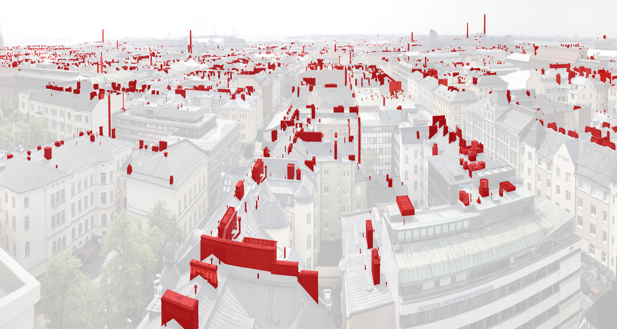
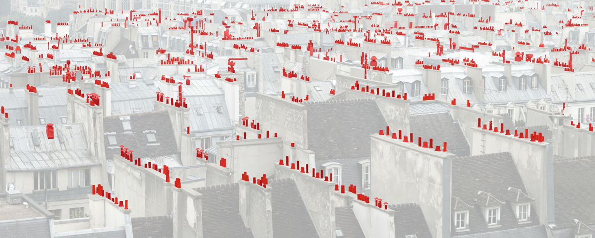
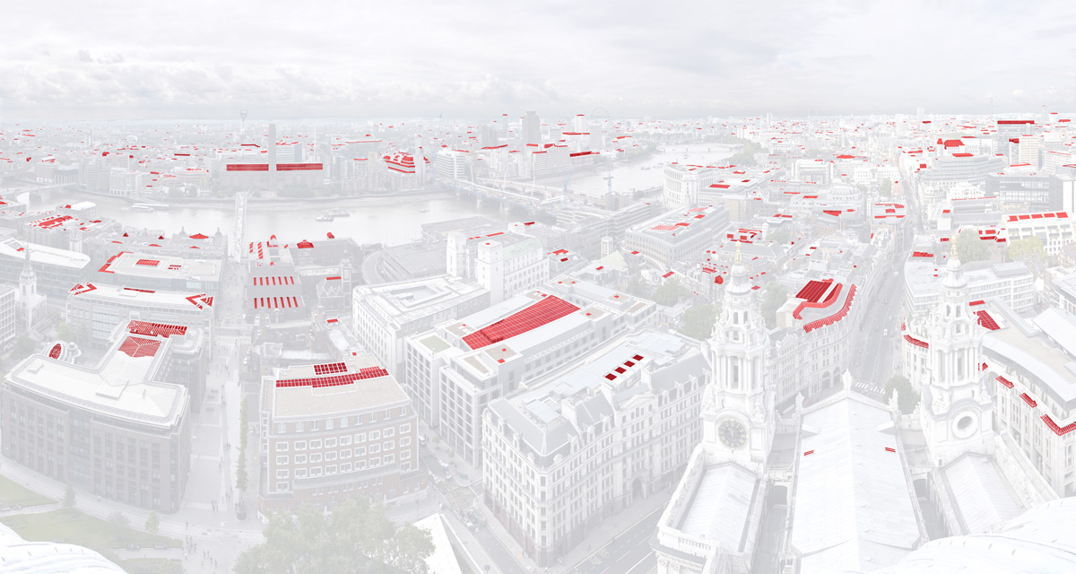
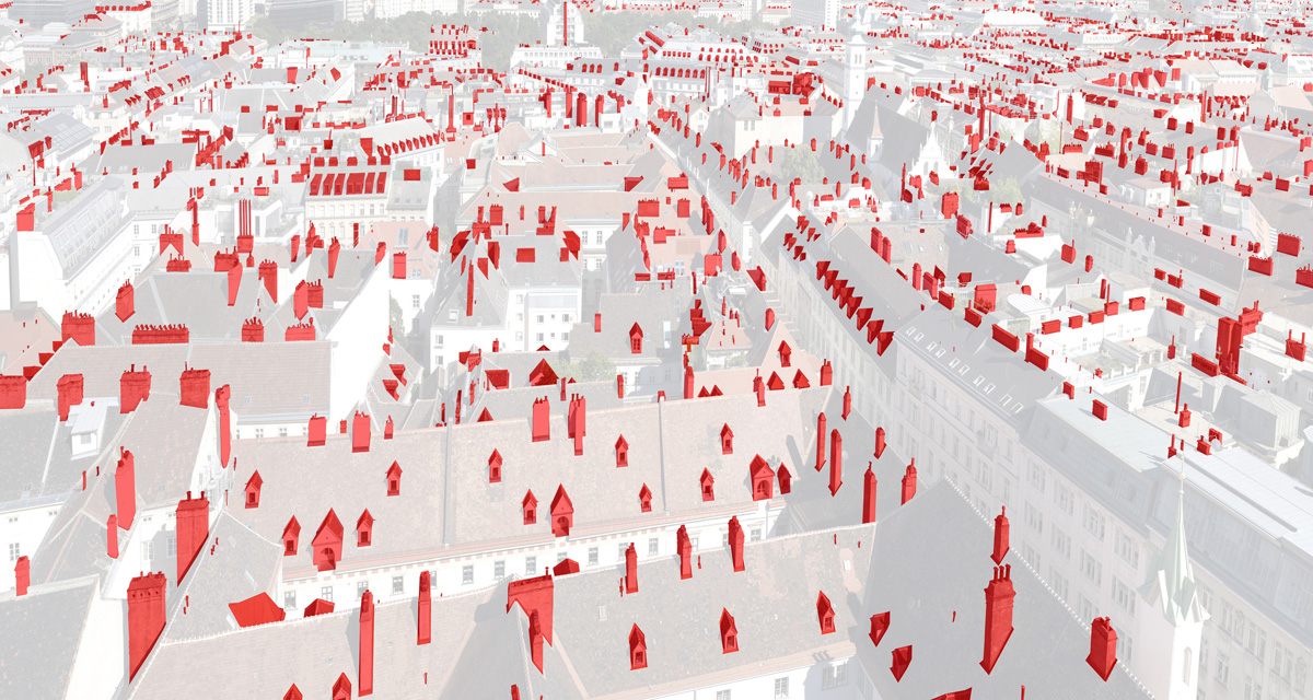
O projeto de García abarca os 27 países da comunidade europeia. Suas paisagens urbanas explicitam os elementos arquitetônicos externos visíveis e comuns sobre os telhados. Cada cidade figura ummapa “diferente” que responde a modelos urbanísticos e sociológicos substancialmente distintos em cada uma das capitais europeias, e aponta para a homogeneização desse padrão entre aqueles que aí vivem. Uma visão da possível/impossível in-dependência pessoal na sociedade européia no século XXI e um mapa global das in-dependências na Europa.
Cantabria (Espanha)
My work is done on the basis of experimentation and fusion of disciplines and techniques around the world of the image. In recent projects (developed after an intense documentary work) I have focused my artistic creation in a rereading of the territory, accumulating meanings in images, such as layers, as a synthesis and reflection on what each picture shows and hides. Description of the series In-Dependencias Approximately 70% of the European population lives in countries that have had or have some kind of conflict related to independence. It was therefore an interesting topic to investigate, within a geographical area (European Union) that was equipped with a range of common legal and administrative structures, which has altered the balance of power in international markets, after 50 years of their origin. Economic circumstances and the international financial crisis that taking place in recent years are having a clear impact on the European Union. In the XXI century, borders have lost much of its meaning. The economy is global, trade and consumption have an essential role at the global level. The citizens claim their parcel of personal autonomy, seek their identity, often through their buying power, its external signs, with the financial means at their disposal, or from the overindebtedness. The bastion where we really are us, our little parcel of individuality, it is our home where we are truly ‘free’. However, over our heads, on the rooftops, displays the items that show our daily needs (light, heat, energy, communications …), generating a kind of ‘map’ of distinct units in each city. It sought to identify in each capital the element most frequently on housing, that to some extent indicates a small parcel of in-dependence in the home and create a “map” specific to some extent us back the image of the idiosyncrasies of that place and its inhabitants. My objective was to get a snapshot of Europe in this historical moment, beginning to generate a ‘mapping’ of these needs capital to capital, to obtain (at the end of the process) a picture summary of these dependencies. After 4 years of work and traveled more than 60,000 km. this is the result. In fact, during work, my obsession has been to find the overall image that sums up (somehow) a way to see Europe. To do this, and after studying the configuration of the historic centers of cities and choose a viewpoint and a significant angle, performed the data sheet, and in every city, I made large panoramics (consisting of between 50 and 100 images each), which allowed me to have a “digital negative” of more than 2 gigabytes, enough quality to identify and “paint” digitally after the chimneys, mansards, skylights, satellite dishes or cisterns that draw the “map” specific to each city.
From an artistic point of view, the end result is intended to make explicit a view of the possible / impossible personal in-dependence on the XXI century European society and a global map of in-dependence in Europe.
Recent Comments